Interacting with Svg map Objects
The Svg map Object provides the following interactive features:
-
Map popover
-
Pan, zoom, interactive selection
-
Other features in the contextual menu (sliding toolbar)
Any changes made to the map using the functions listed above will be lost if you leave the Screen or update it.
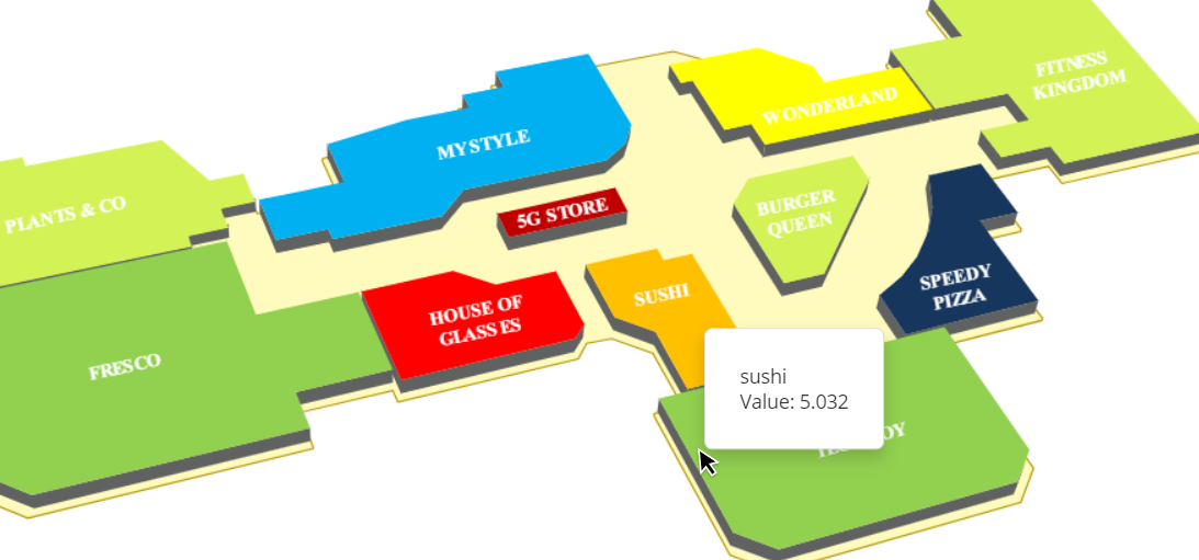
Map popover
When you hover over a map area, a map popover with values related to the Entity set By row will appear.
Pan, zoom, interactive selection
Depending on the map configuration, you can perform specific actions.
Available actions are:
- Pan. You can navigate the map by clicking, holding the left mouse button and dragging the mouse in the direction you wish to pan the map. You can also move the map North, South, East or West using the pan arrows in the lower right corner of the Object area (if enabled)
- Zoom. You can zoom in or out the map using the mouse wheel. You can also do this using the plus and minus buttons in the lower right corner of the Object area (if enabled)
- Interactive selection. To apply a selection on a map, select a set of map areas by holding the CTRL button and clicking on them, then click the Select icon (
 ) that will automatically appear in the sliding toolbar. The selection is applied as a Screen selection and all other Objects on the Screen are updated accordingly.
To reset the selection, click the reset button ( ) in the top left corner of the Object area.
The Contextual menu (sliding toolbar)
When you hover over the Object area, the contextual menu icon (![]() ) appears in the top left corner. Click on it to reveal the contextual menu as a sliding toolbar. You can fully expand it by clicking on the downward facing arrow on the right.
) appears in the top left corner. Click on it to reveal the contextual menu as a sliding toolbar. You can fully expand it by clicking on the downward facing arrow on the right.
The contextual menu includes the following icons by default (unless otherwise configured):
- The Layout icon
 . Opens the Layout editor
 - XLSX icon
 . Exports data in a MS Excel Worksheet as a flattened table
 - Export printable report
 . Export the map as a PDF file or a PNG file (image)
 - Comment icon
 . Displays any comment attached to the map (if any). Depending on the comment configuration, the icon displayed can be a balloon icon, a question mark icon or an alert icon
Learn more about: